Гладкий Международный

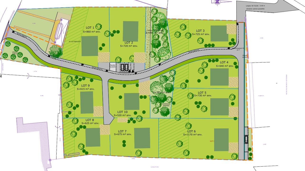

An incredibly lifelike, richly detailed, photorealistic top-down architectural overview of a co-housing community development. The scene is illuminated by bright, even daylight, creating a clear and informative atmosphere. Captured with a high-resolution drone camera, emphasizing the planned layout and green spaces with crisp, clean lines and vibrant, distinct color blocks representing different zones and planned structures. The image showcases a carefully planned development of ten residential lots integrated into an existing urban fabric, designed to reinforce the character of the old town. The natural topography of the land is respected and enhanced by the inclusion of existing landscape elements, such as a communal washhouse and hedgerows. A main road runs through the site from south to north, supplemented by secondary access routes, communal public spaces, shared and private parking areas, and a community orchard. The architectural styles of the planned buildings are designed to harmonize with the surrounding structures, featuring some lots with flat, green roofs and others with double-pitched roofs that echo the existing built environment. Utility networks, including water, electricity, sanitation, telecommunications, and fiber optics, will be connected to existing infrastructure, with rainwater management handled through swales and a retention basin. Particular attention has been paid to the landscape quality, the use of local plant species, and architectural integration to ensure a coherent and sustainable insertion into the village environment. The overall composition provides a clear and comprehensive plan of the development, with individual lots clearly delineated and labeled with their approximate surface areas, and strategic planting patterns indicating future green spaces and communal areas.