Землистый Обыденный

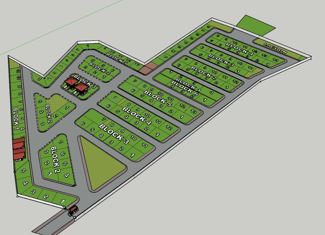

An incredibly lifelike, richly detailed, photorealistic aerial view of a co-housing community master plan. The scene is illuminated by bright midday sunlight, creating sharp, distinct shadows and highlighting the textures of the developed lots and open spaces, setting a grounded, earthy, and vernacular atmosphere. Captured with a wide-angle lens from a high vantage point, the rendering emphasizes the meticulously planned layout of housing blocks, roads, and communal green spaces. The flat, undifferentiated background has been transformed into a subtle, light-gray, matte surface, suggesting a boundless, minimalist canvas that keeps the focus strictly on the architectural plan. Asphalt roads exhibit a deep, grainy texture with realistic tire marks, bordered by weathered, light-gray concrete curbs that show subtle imperfections. Each housing lot is now a segment of vibrant, well-manicured light-green grass, with individual plots clearly delineated by slightly darker green borders, suggesting freshly mown turf with subtle variations in blade density. The few depicted structures, like the guardhouse and residences, gleam with realistic materials, their red tile roofs exhibiting the natural variation of fired clay, while their walls possess a subtle texture. A few strategically placed, modern cars are visible along the access roads, rendered with high-fidelity paint finishes that cast faint reflections on the asphalt, providing a sense of scale and everyday life. The overall perspective maintains the original bird's-eye view, allowing the viewer to absorb the complete layout, from the intricately numbered housing plots in Blocks 1 through 6, to the designated "Lagoon" area, all integrated seamlessly within the clean, defined boundaries of the plan. The ray tracing and global illumination techniques have imbued the scene with a tangible realism, making the materials feel palpable and the spatial relationships between the blocks and roads clearly defined, as if this were a tangible, fully realized development.